Thursday, November 5, 2015

Old Town Negaunee, Pt. 2

So, wasn't long after leaving the train embankment, that I caught glimpse of a ruin of some sorts as I was walking back to my truck. Well, this is what I came out here for, so I went in for a good look! Whatever this place was, it was a decent sized building. At first I thought it was probably just a house, but upon closer examination I think this place had a purpose other than just a home.


Well, at the very least it'd been a popular drinking spot for the locals for some time. Pull-tab cans! Someone should make these again.


Found this cool brick in the ruin.  Not really sure what any of it means. Still, anything with writing is pretty neat in my book!


This is where it was sitting. Obviously the pull tab beer guys had liked this brick too, and set it out for me to find later.


Backside of the steps that would have led into this building. Not a full basement, just a good sized crawlspace apparently.


Another brick with writing! I wonder who Lacey was?


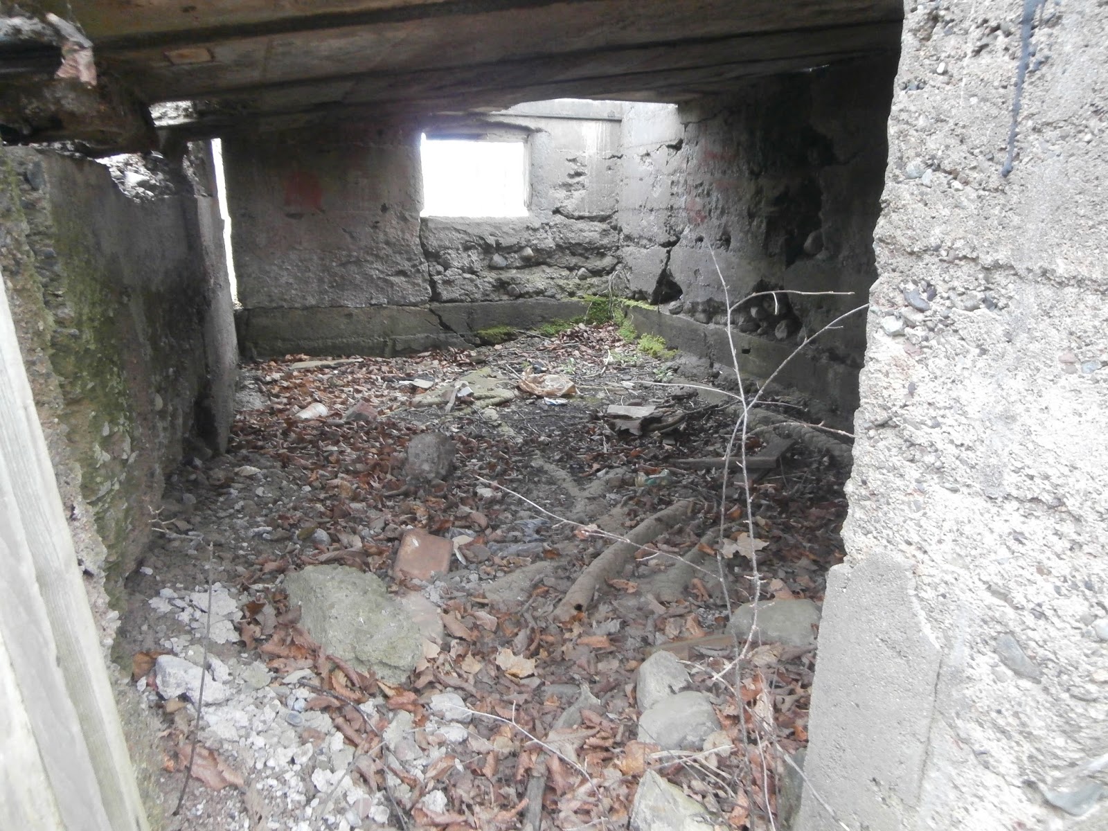
 So, standing in the foundation with a floor support to my right, I could see there was a covered area off to the side. Of course I moved in for a closer look!


 It had a concrete roof that had partially collapsed, and a small window or access chute coming off the other side.


 There also seemed to be a hinged door on top of this area. Since this would have been the floor originally, I imagine there was some sort of storage access to this room below. Why this area would have had a concrete floor is perplexing. Maybe this was actually outside?


Looking into the room I could see someone had been camping here at some point. Notice the piece of carpet on the floor? Also, i noticed that this door i was looking into had a wooden frame on it at one point. It was still on the left. Either this basement was dug out more at some time and had been filled up over time, or this was a seriously short basement, and you better duck when you were down here! I'd practically have to get on my knees to get in here. The ground didn't look to appealing, so maybe next time. Ha! 


So, it looks like taking old rails and using them to reinforce concrete was a big thing back then. I guess when rails were always coming at going like they did around here, that you needed to reuse them somehow. Pretty resourceful I'd say! 


Here's a close up of the opening from the top down into the little room. That hinge looks like it held on a pretty solid door! I wonder what they kept down in there?

It wasn't the only "room" in that foundation. There was a few other smaller sections, all along the same side of the building. Here's the shot into the next one over. More beer cans and trash, but I think that wood is from the original floor. Also, two very different kinds of wall here. Maybe newer construction on something older?


Stairs to the entrance? I wonder what this place was. If I ever learn about it I will have to do an update!


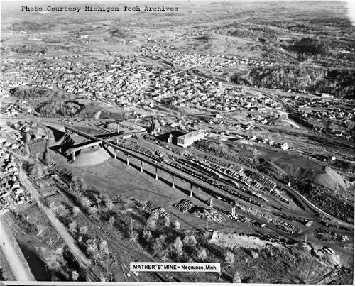
Hard to see here, but the outline of a foundation was right under the grass here. See how there is gold grass in the middle, and then the lighter less bright grass on the bottom of the picture? That's where there was a concrete wall. The higher ground was closer to me, and the golden grass was in the lower land. Considering how the water level was much lower here than it used to be, I wonder if this was right on the water? Again, the Mather's "B" hoist house is the monolith on the hill to the right.

Looking back into the ruin. Obviously been a while for all these trees to grow up in here!


The stoop for the side of the ruin facing the road. This is the one I took a picture of the other side from down in the foundation. You can see the floor supports behind it. 

I'd poked around that ruin enough, so I sauntered back over to my car, taking this picture of the tailing pile. This was a good size pile of rocks! Shortly after I took this two deer were spooked by my less than stealthy approach. Much to my surprise they ran right up the side of this hill! It's all loose rock, but they must have been part mountain goat because they made it up with any problem.


Wasn't but a little ways up the road before I spotted another ruin through the trees. Fall is a great time to go looking for these things because the leaves any shrubs aren't blocking your view. I probably drove by this place 4 or 5 times this summer and never noticed it!


You know something has been sitting there for a while when a cluster of trees grows up and lifts a slab of concrete! 

This place feels much older to me. It's a foundation that appears to be made of left over poor rock from the mines. Also, it could seriously use some more mortar! 

Lucky for the person who built this there was no shortage of leftover rock to build with. In the upper left of this photo you can see just how close this foundation was to the Mather's "B" waste pile. Certainly there are more foundations buried underneath its massive heap! 


Looking into the ruin, there was definitely a newer piece of brick wall built at some time. I wonder what it was for? Was this a functional basement, or simply a crawlspace? If so, perhaps it was simply added support for the floor above? Again, judging by the size of the trees growing up from here, I'd say this place hadn't been bothered with in a while.


Crazy old, barely any mortar holding it together, but I was impressed with how square this corner was. Old craftsmen sure did good work with what they had! 


I love all the different sized rocks they built this place out of. It must have been quite the task building a foundation like that!
The ubiquitous tire that invades every ruin found its way here too! 

At first I thought this was just a fallen log, but it showed signs of work on it, so now I think this was a support beam of sorts. One solid piece of wood it was, probably quite sturdy back in the day.


Here's a closeup of that newer wall. I can only guess as to its purpose. Oh to be able to see back in time! What I would give!


 This large slab of rock almost shimmered. I bet it was rocks like this that got the old miners attention back in the day. Definitely some minerals around these parts!


Looking up the tailing pile. My brother and I drove up there when he was here last, but I've been having a hard time finding the road we took. I certainly wouldn't want to climb it!


I went a little closer to the rock formation, and this would be the easier way to the top. Maybe next time though, because I was on way to some good sized ruins that I knew weren't far from here.


On my way back to the truck, I noticed this laying down on the ground. It was an old telephone or telegraph pole! I guess they just knocked them all down for some reason when they left, or its been so long that it just collapsed and broke due to age. Either way, I almost didn't notice it with all the fallen trees around. 


Doesn't look like a modern one. I wish I knew more about these poles so I could figure out how old it was. Judging by the wood I'd say its pretty damn old!


Did these rings help conduct power, or communications? Whatever they did, sure was a lot of them! 

Well, time to head to the next stop

I went to my car and moved along to the large industrial ruins of what I believe was once the active ore concentration facility.

To be continued...

Old Town Negaunee, pt 1

Well, after my visit at the Sundberg Block, I still had plenty of daylight left. I hopped in my truck Ol' Cornelius, and the two of us headed up to the entrance into the caving grounds.

First, a little more background on Negaunee:


Located in the heart of Michigan's upper peninsula, the town lies inland from the port city of Marquette.


In 1844 explorers discovered iron ore in what would later become Negaunee. During the surveys of the state, the noted surveyor and explorer William A. Burt arrived at Teal Lake. Legend has it that Burt's compass never pointed in the same direction while he was in the area due to the large deposits of magnetic ore abounding.

Later, in 1845, a group of men left Jackson Michigan to head to the Keewenaw peninsula. There had recently been copper discovered there, and a mining boom was in full swing. However, on the way to copper country, the Jackson miners heard a tale about shiny rocks found at the mouth of the Carp River. The men decided to abandon their previously laid plans, and make for this new discovery.

When they arrived in the area the men enlisted the help of the local Ojibwa Chief, Marjigesick to help them find what they sought, and they were not disappointed. Huge deposits of iron ore were found breaking free of the surface. The area was full of resources, and these men meant to exploit! They started the Jackson Mining Company, and began mining in earnest. The boom was on! It wasn't long before mines were springing up all around the area. Mindat, a trusted source for information regarding mining around the country, lists over 50 mining sights in Negaunee alone! This doesn't include the many more in the surrounding area. The region was mined quite heavily during the second half of the 1800s, and on into the early 1900s.

North Jackson Mine, 1860s:

 
The city enjoyed boom times during this period, and the population was both large and fairly wealthy. Many nice homes were built, and people enjoyed a fairly good standard living for being in such a remote and harsh location.

Negaunee’s Iron Street on March 13, 1899. Winters can still be harsh and unforgiving up here even with today's conveniences like snow blowers and gas or propane furnaces!

All in all it was a good time for the city, and while the mines kept open things only seemed to be getting better. The city even had an advanced trolley system for its day! Notice the Sundburg on the right? The tracks went right past it.


However, good things don't usually last. The mines begin to close, and people begin to move away from the city seeking work elsewhere. The Jackson mine closed in 1927 and it wasn't until the 1950s that large scale mining came back to the site, though nowhere near the scale of the 19th century operations.

During the early part of the 20th century, there were a few cave ins of mines in the city. Considering how most of the city is honeycombed with tunnels from the mines underneath, this began to cause worry with the residents. Many parts of the town were deemed "unsafe" by mining engineers, and homes were either torn down, or if possible relocated. Starting in 1927, the eastern parts of the city were abandoned do to cave ins, and in 1955 the Negaunee Mining Company feared that caving would soon reach the surface of the west side of town. Fearing this many of the residences near the old Jackson mine were moved or demolished.

Shortly after that in the 60's there was talk around the reopening of the some of the mines in the area. They reopened some of the Jackson mines but called them the Mather's "A" and Mather's "B" mines. The Mather's "B" shaft was planning on mining right under residences, so the city and the mining company decided to close even more of the western side of town! By this time over half the city had been completely abandoned! Nowadays this abandoned area is called "Old Town" by the locals, and is a great place for exploring!
 
Now today with all the mines in the city closed down, there's no more fear of cave-ins for most of the previously closed off areas, and the powers-that-be have decided to allow access again. One has to be careful however, because there are still dangerous areas and mine-shafts around. While some fences are old and rusty, there are quite a few that are well maintained and obviously still blocking off dangerous areas! Better to be cautious than dead down in a mine shaft! 

Shown below are a couple of the previously blocked off entrances into the caving grounds. Notice how the pavement of the road changes? There's also abandoned sections of sidewalks and street signs that are over 60 years old! I'll be revisiting many places here with this blog, so there will be a more pictures to come.


I personally like to take the entrance that goes by this old house with the school bus out front. Something pretty cool about an abandoned old school bus!


Once you enter Old Town, it's obvious that the entire place has been left to nature for quite some time. The roads have crumbled and the grasses and trees have grown unchecked. It's hard not to think about if the rest of the world will be reclaimed by nature in much the same way someday. When people are gone, mother nature always takes back what's hers!


As you can see, the Marquette County Road Commission has long since given up on these roads! This was actually one of the GOOD parts. Not something I'd like drive a low car on.


Gates like this one below were erected to keep people out during the roughly 50 years this place was considered off limits. Now, they are open and sit as a reminder to all that it wasn't until recently that someone decided this place was safe. Every time I pass through one of the previously blocked off areas, I can't help but think about there is thousands of feet of tunnels and caverns right underneath my feet. Sure, they're all over the town, but in here they were the most extensive. Many came within just 100ft of the surface!


 In the distance I could see the hoist machine house of the Mather's "B" mine-shaft. Operating from 1950 till 1978, it was one of the last of the underground mines to operate in the area. All new mines in the region are open-pit mining operations.


I'd visited this building before with my brother. It's VERY impressive on the inside, and has a lot of machinery still in place! Neither he nor I realized what the place was at the time, and we were right by the shaft itself! The building next to it is actually the old mining administration building, and currently is the local high school. We were probably really lucky no one saw us! I hope to make a return trip sometime.


The distance doesn't really do much to convey the size of the place. Blogger SubStreet made it in there and managed to get some decent pictures of the inside. If you'd like to seem them, his blog is here.

Here is an aerial photo of this area during the height of the mines operation. The area I am in is directly behind the hoist house that you can see in the middle of the picture. One can see how the area I'm in is actually full of buildings at this time. It was quite the undertaking to remove or demolish all those structures!


Looking to my right was an idyllic little scene of a creek flowing and what looked to be a ruined wall of some sorts off to the right. This area would draw my attention in soon. and I would head that way next.


But first, looking behind me from that last shot, up the source of the creek. This area was drained extensively in preparation for the mining operations at the Mathers "B" shaft. At the time the water table dropped some 27 feet! Many wells had to be put in, and they are still poking up out of the ground in many different locations in Old Town. Off to the right in the picture below you can see the outline of the waste rock pile from the mines. This rock, also called "tailing", was carted out of the mines and usually just dumped into extremely large piles. It's hard to tell in this shot, but that's no small hill! Some piles are hundreds of feet high!


Well, I decided I should take a look at that wall. Once I got closer I could tell this was a retaining wall of sorts. Made of loose stone, it was hard to judge how old it was. It looked neat though, and I figured I'd continue up the rise and see what was just on the other side.

Boy was I not disappointed! The embankment for the train bridge that ran up past the mine! I think you can actually see it in the old picture I posted a little above. It's just above and to the right of the square building in the middle. It kinda gives you an idea of the scale. This guy had quite a bridge to go up to!

The bridge had long since been removed for scrap, but I guess this was simply too big to demolish, so they left there.


Considering how long it has just been sitting here, it's in pretty good shape! One thing I noticed is the lack of graffiti. One thing that's nice about being so remote up here, is that the usual groups of hoodlums and vandals you get in larger populated areas just don't find the time to come way out here. During this whole trip out here, I only saw one other person, and they paid me no mind.


Well now, isn't that an imposing view!


From the base of the bridge I could see the remains of what I think was another rail line that passed under it, heading back towards town.


The trees lining it clearly pointed to it being either a small rail line or a road. I would have walked a bit down it, but this imposing fence was actually pretty effective at blocking off the path. I could have gotten around, but exploring by yourself, one has to be a little cautious. I'm not about to cut myself open on some old barb wire, fall and break my leg, and bleed to death in the woods. Nope. That's not on my list of things to do!


I climbed around to the top of the embankment, and this is the view looking off the direction the tracks would have ran. Couldn't get right by the edge without some dangerous maneuvers, so this shot through the barb wire was the best I could do.


Looking back behind where the train would have come up. Certainly no sign of old tracks at all. It must have gone over the road? I need to examine some more detailed maps and try to figure that part out. I'll revisit the topic in a later blog when I discuss in more detail the different railways of the area.


Now, it looks to me like they cut off the bridge part of this. That metal looks to me to be rail line that had been repurposed into reinforcing the concrete of this bridge. Not to mention what looks to be local stones thrown in there for good measure!


They sheared this old rail/re-bar off good! Must have been quite the tool!


Coming back down to the truck, the Mathers "B" hoist machine house dominates the distance. The hills you see are all tailing piles from the mine. It churned out a LOT of ore, thus a LOT of waste rock!


Well, I hopped in my truck, and moved down the road. Still had some daylight left, and there was a lot more to see!!!

To be continued...